In Forensic Architecture’s work, physical and digital models are more than mere three-dimensional representations of proposed structures – as they are typically used in architectural practice – but rather function as analytical or operative devices. Spatial and non-spatial models provide a theoretical understanding of the way in which particular incidents may have unfolded, or can help make predictions as to how certain situations might develop. Others are used to test, simulate, create and present evidence. They are OPERATIVE MODELS, to paraphrase filmmaker Harun Farocki’s concept of ‘operative images’ – entities that not only represent, but ‘do’ things in the world, serving as essential means to construct evidence and assemble a forum around it.
In the FIELD, the process of re-enacting incidents can turn a crime scene into a self-referential model, a spatial representation that overlaps the place it represents. In the LABORATORY or STUDIO, spatial models constructed within digital environments can provide evidence by simulating material processes such as the impact of a blast or the progression of fire and smoke through the air. They allow the manipulation of time, freezing or bifurcating it to test alternative scenarios. Models are also used as interview devices to enable testimony, and can become archival repositories or spatial information systems in which other kinds of evidence – images, videos, documents or material things – are summoned up and cross referenced.
In the FORUM, the presentation of physical and digital models rearranges the relation between objects and bodies in space. Such models can serve to shift the means of communication, and to focus attention, allowing for the demonstration of complex claims on the terms of those that want to make them. To become operative across these domains, models need to be calibrated with the physical phenomena they seek to represent. The term GROUND TRUTH refers to such a process of anchoring elements of a representation to its source. Just as a satellite image analyst needs to compare pixels in an image with empirical data on the elements on the ground in order to calibrate material, colour and scale, so the modeler needs to align elements of digital models with their equivalent elements in physical space. The notion of GROUND TRUTH highlights the ever present gap between reality and its representation, and the importance of such anchoring in testing different possible realities.
On 20 March 2017, Forensic Architecture and ActiveStills undertook a full-scale reconstruction of an incident that took place on 18 January 2017 in Umm al-Hiran in the Negev Desert. In this incident, a Bedouin villager Yaqub Musa Abu al-Qi’an and an Israeli Policeman Erez Levi were killed, with Abu al-Qi’an accused of having intentionally driven his Toyota Land Cruiser into Levi in a ‘terror attack’.
Through the onsite reconstruction, involving villagers and actors, Forensic Architecture set out to test the findings of their initial video analysis, to record situated testimony from participants and witnesses to the event, carry out a 3D photogrammetric survey and measurements of the scene for further digital analysis, and search for elements of the incidents that were not captured by video. Through the modelling and measurements Forensic Architecture could clearly link the car’s autonomous acceleration to the 15% slope of the topography.
The M2 hospital in Aleppo, Syria, was subject to continuous airstrikes by Russian and Syrian forces from June to December 2016. Hand held and CCTV videos taken in the hospital captured the precise moment many of the strikes hit. When posted online the bombing of the hospital was denied and the videos decried as fabrication, or as coming from places other than the M2 hospital. It was therefore necessary for Forensic Architecture, in collaboration with the investigative agency Bellingcat, to demonstrate that all videos could be matched within the architecture of the building and how they might be connected to each other. The model helped arrange the multiple images into an archive and a narrative.
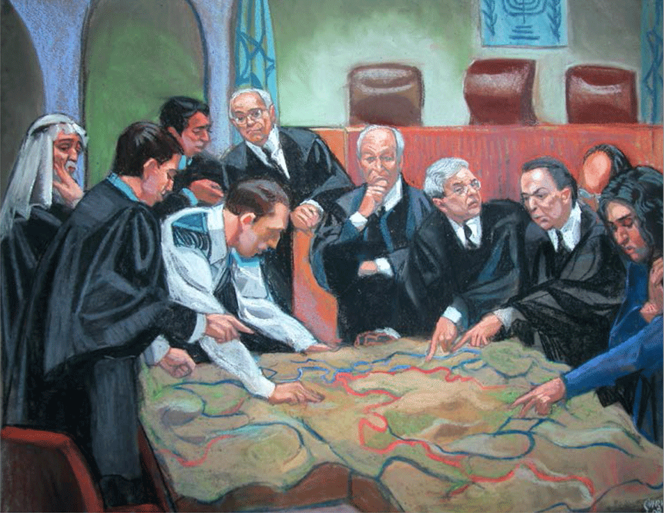
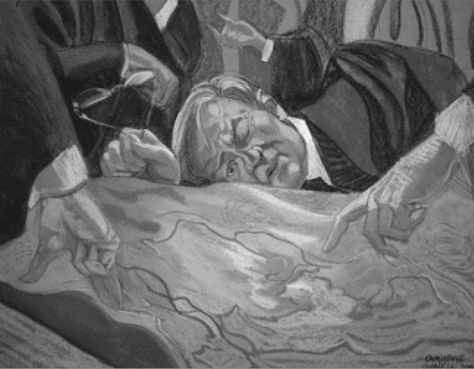
In 2004 the Palestinian village of Beit Surik, north of Jerusalem, was the first to petition against the Israeli Segregation Wall in the Israeli High Court. When a topographical model showing the path of the Wall was brought to court the parties had to leave their assigned places and assemble around it. The physical properties of the model interrupted the court’s protocol and its formalities, and the legal process came to resemble a design session. The model shifted the discourse towards material considerations, yet also served to legitimise the very presence of the Wall. Images courtesy of Christine Cornell.


no. 236848.